How To Read The Pompeii Map: Regions, Entrances And Routes
A map of Pompeii looks like a dense grid of Latin numerals and strange shorthand, yet the system behind it is simple once you know the three entrances, the nine regions and how door numbers work. This guide explains how to read it, which routes are shortest, and where the interactive pin map fits in.
Short answer
Pompeii, the ancient Roman city buried by Vesuvius in AD 79, is mapped in nine regions, each split into insulae numbered blocks, with addresses like VI.15.1. The three ticketed entrances are Porta Marina, Piazza Esedra and Piazza Anfiteatro, plus Porta Ercolano for the villas route. The excavated area covers 44 ha inside a 98 ha UNESCO property.
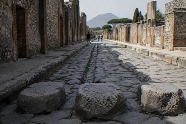
Pompeii, the ancient Roman city buried by the eruption of Mount Vesuvius in AD 79, sits in Campania, southern Italy, beside the modern town of Pompei and about 24 km by road from Naples, and its map defeats a surprising number of visitors before they reach the first crossroads. The city is not a ruin you wander through shapelessly: it is a formally organised grid, divided by excavators into nine regions labelled with Roman numerals, each cut into numbered blocks called insulae, and every house door carries its own number inside that system. Read the system once and everything on the plan falls into place, from the forum of Pompeii out to the suburban villas beyond the walls. For pin-by-pin navigation, the site's own interactive map of Pompeii plots the landmarks you will actually look for, and this guide explains how to read a printed plan the way archaeologists do.
How The Nine Regions Of Pompeii Work On The Map
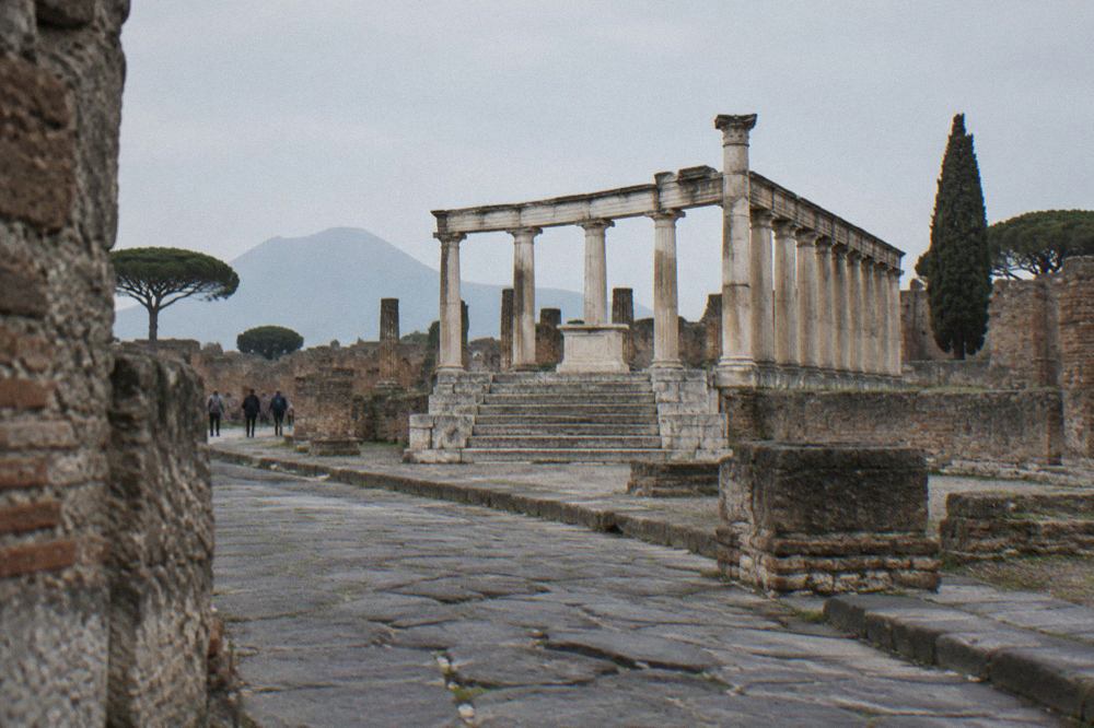
The excavated city of Pompeii is divided into nine regions, numbered I to IX in Roman numerals, and each region is subdivided into insulae, numbered blocks bounded by the ancient streets, so that any building can be cited as a region number, an insula number and a door number in one compact address. This is the system archaeologists use in every report and every guidebook, and once you recognise it, the map stops being decoration and becomes an index. The convention matters for visitors because directional signs inside the park, and the labels on every serious plan, use it. A fuller walkthrough of what each zone contains is in the guide to Pompeii regions explained, which pairs each region with its landmarks.
The regions run in a rough sequence across the city, with Region VII holding the civic heart around the forum and Region VIII below it toward the Marina gate, while the amphitheatre end of the city sits in Region II at the Piazza Anfiteatro side. Not all nine regions are equally open or equally excavated, and the park's own materials describe an excavated area of 44 ha within a UNESCO inscribed property of 98 ha, so parts of the plan you may see in older guidebooks remain under the volcanic blanket. The lesson for map-reading is practical: a plan of Pompeii is a map of what has been uncovered, not of the whole ancient city.
Door numbers are the third layer. An address such as VI.15.1 means Region VI, insula 15, entrance 1, and famous houses are universally cited this way, which is why the house of the Faun and its neighbours are easier to find by region number than by street name. Ancient street names are partly modern scholarly reconstructions, and several streets carry popular names that appear on no Roman inscription, so the numeral system is the reliable one.
Which Pompeii Entrance Should You Choose For Your Route?
Choosing badly does not lock you out, but it can add a long, hot walk at the wrong end of the day.
| Entrance | Where it sits on the map | Best for | Notes |
|---|---|---|---|
| Porta Marina | Lower city, near the forum end | Forum-first classic route, arrivals from the Pompei Scavi-Villa dei Misteri station | Steep ancient ramp up from the gate |
| Piazza Esedra | Central-east side of the excavations | Balanced half-day coverage | Connects to the Antiquarium lift on the accessible route |
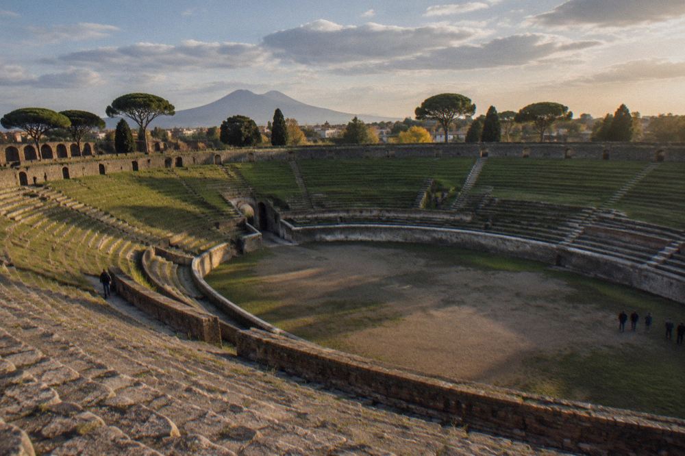
| Piazza Anfiteatro | Far east end, Region II side | Amphitheatre, Large Palaestra, accessible route start | "Pompeii for All" entry point for visitors with mobility difficulties |
| Porta Ercolano / Street of the Tombs | North-west edge | Suburban villas route to Villa of the Mysteries and Villa of Diomedes | Express ticket holders add this route for EUR 8, card only, in 2026 |
The station named Pompei Scavi-Villa dei Misteri on the Circumvesuviana line serves the Porta Marina side, and trains from Napoli Garibaldi take 29 to 35 minutes to reach it, a figure computed from the operator EAV's own published timetable data. Arriving by train therefore tilts the map decision toward Porta Marina, and it is worth reading the fuller comparison in Naples to Pompeii before committing to a direction of travel. Note also that the Campania Express service, which once offered a faster train option on this corridor, has been suspended since 1 October 2026 with no restart date announced.
For anyone with mobility difficulties, the map matters more than for anyone else: the park's regulations describe the "Pompeii for All" route entering at Piazza Anfiteatro with an exit option at Piazza Esedra via the Antiquarium lift, and planning the day around those two points avoids the steep Porta Marina ramp entirely.
Where Do The Interactive Pin Map And The Printed Plans Differ?
The interactive pin map of Pompeii, which lives on this site at the /map/ page, plots individual landmarks as searchable pins, while printed plans compress the same city into fixed sheets that work without signal, and the two formats differ mainly in how they handle the region grid, the walking routes and the ever-changing closures. A printed plan never tells you that a building has just shut for maintenance, whereas the pin map can carry a status note. That difference became concrete in September 2026, when the Praedia of Julia Felix closed to the public from 7 September 2026 for maintenance until further notice, leaving printed guidebooks pointing at a shuttered compound.
The practical reading order for a first visit is simple: open the interactive map of Pompeii to pick your must-see pins, then sketch the shortest line between them on the printed plan, because battery life and mobile signal inside the stone canyons of the ancient streets are unreliable friends. Carry water regardless; the guide to Pompeii in summer heat covers how the exposed grid behaves when temperatures climb.
One thing both formats share is the address system described above. Whether the label reads VI.15.1 or pins a house on the Via della Fortuna, the underlying reference is the region and insula grid, and guides such as the one to Pompeii graffiti cite locations exactly this way because it is the only unambiguous system the whole literature agrees on.
What Are The Shortest Walking Routes Across Pompeii?
The shortest classic circuit enters at Porta Marina, climbs to the forum in Region VII, runs the length of the main east-west street toward the Stabian Baths, and returns without crossing the full grid, while the fastest amphitheatre circuit starts at Piazza Anfiteatro and never leaves Regions II and I, and both are far shorter than the figure-of-eight routes that try to cover all nine regions in one pass. The geometry that matters is that Pompeii is long from north-west to south-east, and the forum sits at one end of the long axis, so any route that starts at the forum and ends at the amphitheatre commits you to the full length of the city.
| Route | Start and end | Regions crossed | What it covers |
|---|---|---|---|
| Forum-first circuit | Porta Marina in and out | VII, VIII edges | Forum, Basilica, Temple of Apollo, baths quarter |
| Long-axis route | Porta Marina to Piazza Anfiteatro | VII through to II | The full city: forum, main streets, theatres, amphitheatre |
| Amphitheatre loop | Piazza Anfiteatro in and out | II and I | Amphitheatre, Large Palaestra, eastern domus |
| Villas extension | Porta Ercolano / Street of the Tombs | Outside the walls | Necropolis, Villa of the Mysteries, Villa of Diomedes |
Time bands shape the map too. The park splits the day into two admission windows in the summer season, 9:00 to 13:00 with a cap of 15,000 visitors and 13:00 to 17:30 with a cap of 5,000, and the afternoon window is the quieter one on the map. If your plan starts at the far end of the city, remember last entrance times: 17:30 with a 19:00 close from 16 March to 14 October, and 15:30 with a 17:00 close from 15 October to 15 March.
A guided option changes the map-reading burden entirely. The archaeologist-led small-group tour that also includes the entry ticket is described on its own page, where the live listing shows dates, the current price and everything included; read the tour profile at Pompeii entry ticket and guided tour and Check availability if that format fits your dates.
How Do House Numbers And Street Names Work When You Are Lost?
When you are lost in Pompeii, the fastest fix is to find the nearest region numeral on a wall plan or signpost, then work outward by insula number, because street names on modern plans are partly scholarly conventions and several popular names appear on no ancient inscription, while the region-insula-door grid is used consistently across every official park map. The numerals are large, painted and carved on signage throughout the site, so a landmark address resolves in seconds once you know the pattern.
The same grid powers every cross-reference you will meet in books and on this site. The guide to the house of the Vettii, the profile of the house of the tragic poet and the walkthrough of the house of Menander all cite their buildings by the standard address, which means a printed plan with the region numerals marked is genuinely the only tool you need to move between a guidebook and the ground.
Bags and size rules affect your route planning more than visitors expect. The park regulations permit bags only up to 30x30x15 cm inside the excavations, with larger items going to left luggage, so a plan that zigzags back to a locker is a plan with a hidden detour. The logistics are covered in detail in the guide to Pompeii luggage storage.
Which Landmarks Anchor The Map Of Pompeii?
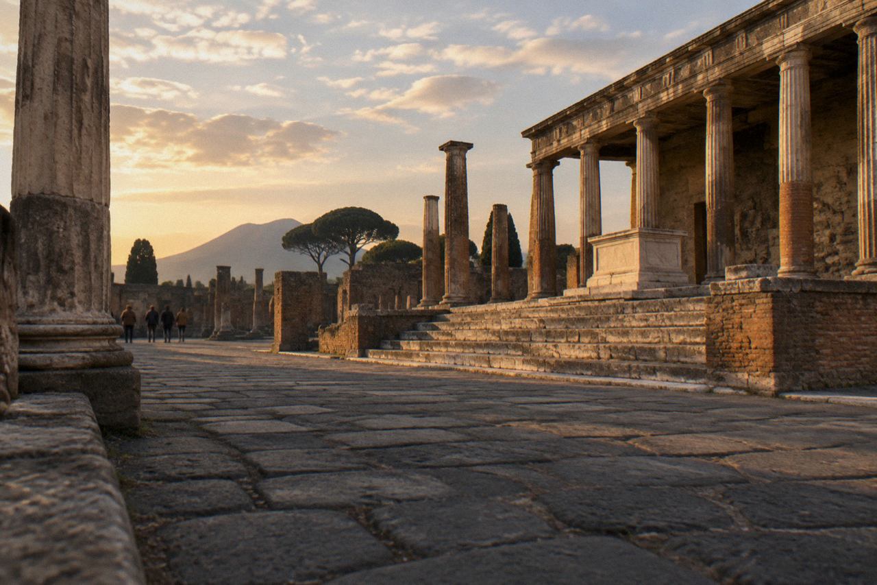
The five anchors that orient almost every visitor are the forum in Region VII at the civic heart, the amphitheatre at the far eastern end, the Stabian Baths midway along the main axis, the Villa of the Mysteries outside the north-west walls, and Porta Marina at the lowest point of the city, and every other landmark on the plan is easiest to place in relation to one of these. Fix those five and the rest of the grid hangs off them like coordinates.
| Anchor | Position on the map | What it is |
|---|---|---|
| The Forum | Region VII, civic centre | Religious and civic square at the heart of the city |
| The Amphitheatre | Eastern end near Piazza Anfiteatro | Oldest surviving Roman stone amphitheatre, in Region II |
| Stabian Baths | Mid-city on the main axis | Oldest of the bath complexes |
| Villa of the Mysteries | Outside the walls, north-west | Suburban villa famous for its fresco cycle |
| Porta Marina | Lowest western point | Original sea-facing gate near the forum end |
Between the anchors sit the buildings people actually cross the city for: the thermopolium of Vetutius Placidus on the main street, the bakery of Modestus, the lupanar, and the haunting garden of the fugitives with its casts. The story behind those casts is told in the guide to Pompeii body casts, which explains what you are actually looking at, a question the map never answers by itself.
How Does The Map Extend To Vesuvius, Herculaneum And The Other Sites?
The map of Pompeii is really one corner of a wider map of the Vesuvian sites: Herculaneum lies at Ercolano to the north-west, Oplontis at Torre Annunziata, the Stabiae villas and museum at Castellammare di Stabiae to the south-east, Boscoreale inland, and Mount Vesuvius above them all, and the park's own 2026 ticket structure already groups several of these under one pricing system. The three-day ticket in 2026 covers Pompeii plus Oplontis, the Villa Arianna, the Villa San Marco, the Stabiae museum and Boscoreale, which tells you the park itself treats the sites as one system on one mental map.
| Site | 2026 ticket | Notes |
|---|---|---|
| Pompeii (ancient city) | Express EUR 20, Pompeii+ EUR 25, 3-day EUR 30 | Prices in force through 31 December 2026 |
| Herculaneum | EUR 16 full, EUR 2 reduced | Villa dei Papiri and the Ancient Theatre are closed for works |
| Oplontis | EUR 8 individually | Closed on Tuesdays |
| Stabiae site (villa and museum) | EUR 8 individually | Closed on Tuesdays |
| Boscoreale, Villa Regina | EUR 8 individually | Includes the Antiquarium |
A pricing change is coming that redraws this part of the map: from 1 January 2027 the Express, Plus and 3-day structure is replaced by a single EUR 25 ticket covering all park sites, valid 30 days with one entry per site, while Oplontis, the Stabiae site and Boscoreale stay at EUR 8 individually and the MyPompeii Card stays at EUR 45. The details are in the guide to Pompeii tickets, and the history behind what you are mapping is in Pompeii history, including the debate over the traditional 24 August AD 79 eruption date.
For the satellite sites, the practical maps are the specialist guides: Herculaneum for the smaller, better-sheltered city, and Oplontis plus the Stabiae villas for the villa circuit. The Vesuvius side has its own rules, with online-only timed tickets for the Gran Cono trail sold at fixed prices per the park's listing, covered fully in Mount Vesuvius tickets.
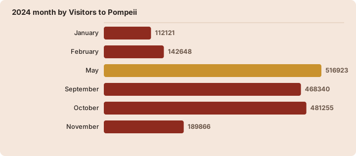
When Is The Map Of Pompeii Quietest To Walk?
| 2024 month | Visitors to Pompeii |
|---|---|
| January | 112,121 |
| February | 142,648 |
| May | 516,923 |
| September | 468,340 |
| October | 481,255 |
| November | 189,866 |
Weather belongs on the map plan too. Open-Meteo's 1991-2020 climate normals for the Pompei grid point show July as the driest month at about 16 mm of rain and November as the wettest at about 180 mm, with August the warmest at a mean daily maximum of about 29.4 C and February the coolest at night at about 6.5 C. Those figures feed the fuller seasonal advice in Pompeii weather and the best time to visit.
Do You Need A Guide To Read The Map Of Pompeii?
You do not need a guide to read the map itself, since the region-insula system is fully self-service once learned, but a guide adds the layer the map cannot supply, which is what each numbered building was and why it matters, and the trade-off between self-guided exploring and a guided two hours is set out in the comparison of a Pompeii guided tour versus self-guided visit. Travellers arriving on rail day trips often split the difference: a short guided block first, then independent map-reading afterwards.
The small-group archaeologist tour is the most common guided format on site and has its own profile page; read about the Pompeii small group tour and decide whether the group format suits your pace.
Visitors who fall for the villa frescoes usually upgrade their map plan to the north-west suburbs, where the Villa of the Mysteries stands outside the walls.
Cruise passengers have the tightest map problem of all, since a ship's timetable shrinks the day to a few usable hours. The guide to a Pompeii cruise ship day solves it with a fixed anchor-first route, and the wider options are compared in Pompeii shore excursions.
What Should You Mark On Your Own Pompeii Map Before You Go?
Mark three entrances, five anchors, one water stop and your exit point, in that order, because the 20,000-visitor daily cap and the nominative ticket rule mean your chosen entrance is fixed to your named ticket, and the anchors, the forum, the amphitheatre, the Stabian Baths, the Villa of the Mysteries and Porta Marina, compress a 44 ha excavated city into a walkable skeleton. Everything beyond that skeleton is bonus ground, and treating it as such is the difference between a satisfying day and an exhausted one.
| What to mark | Why | Where |
|---|---|---|
| The forum | Orientation anchor for the whole west half | Region VII |
| The amphitheatre | End-point anchor for the long-axis walk | Region II |
| A lunch stop | The park's food options sit near the main axis | See the eating guide |
| Your exit and train station | Pompei Scavi-Villa dei Misteri serves Porta Marina | Beside Porta Marina |
For the practical layers around the map, the guides to where to eat in Pompeii and where to stay in Pompeii cover the modern town's offering, and the question of whether the whole day earns its cost is tackled honestly in is Pompeii worth visiting.
Common Questions About Reading The Pompeii Map
How many regions are there on the map of Pompeii?
Nine, numbered I to IX in Roman numerals. Each region is divided into numbered insulae, and each building carries a door number inside its insula, giving every address the form region.insula.door, such as VI.15.1.
Which entrance is closest to the train station for Pompeii?
The Circumvesuviana stop Pompei Scavi-Villa dei Misteri sits beside the Porta Marina entrance at the forum end of the excavations. Trains from Napoli Garibaldi take 29 to 35 minutes to reach that station.
Is Pompeii accessible to visitors with mobility difficulties?
Yes, on a defined route. The park's "Pompeii for All" itinerary enters at Piazza Anfiteatro and allows an exit at Piazza Esedra via the Antiquarium lift, avoiding the steep Porta Marina ramp.
What do the numbers like VI.15.1 on Pompeii buildings mean?
They are the standard archaeological address: region VI, insula 15, door 1. Guides, guidebooks and the park's own signage all use this grid, which makes it more reliable than street names.
Can one map cover Pompeii, Herculaneum and Vesuvius?
Only conceptually. The sites are separate locations, Ercolano for Herculaneum, Torre Annunziata for Oplontis and Castellammare di Stabiae for the Stabiae villas, each with its own entrance and, in 2026, its own ticket, from EUR 8 at the smaller sites to EUR 16 at Herculaneum.
When is the map of Pompeii quietest to walk?
November through February sees the fewest visitors, from 112,121 in January to 189,866 in November in the 2024 figures, against 481,255 in October that year. Within any day, the 13:00 admission window is capped at 5,000 visitors against 15,000 in the morning.
Read the grid once, mark your anchors, and the city opens up; the interactive pin map at the map of Pompeii and the editorial resources at Pompeii Travel Guide cover the ground floor to floor, from the large theatre and odeon to the sanctuary of Pompei in the modern town.